
Plans for outdoor activities may be hampered by a slow-moving storm system over the weekend and into Memorial Day, particularly in the South.
Two areas of the nation—the interior Northeast and the Plains—will see rainy weather on Saturday.
Only sporadic showers are anticipated throughout the interior Northeast as a nor’easter moves away from the New England coast.
Meanwhile, as a weak area of low pressure forms across West Texas on Saturday, rain and thunderstorms are expected to spread from Wyoming to Missouri.
There could be a few storms that are strong to severe.
Throughout the Ozarks, Missouri, Arkansas, and Oklahoma could experience flash flooding. There is a Level 2 out of 4 risk of flash floods in parts of the Plains and Missouri.
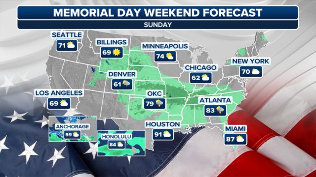
The slow-moving storm system may bring showers and storms, so plans for an outdoor barbecue on Sunday from the central Plains into parts of the lower and mid-Mississippi and Ohio valleys may be in jeopardy. It is likely to rain heavily locally.
Don’t Miss:
- Tri-State Begins to Dry Out, but Cooler Weather Lingers for Memorial Day
- Popular Renton Beach Closed Just Before Memorial Day Weekend
- Above-Average Hurricane Season Forecasted Amid Warming Oceans
On Sunday, a Level 3 out of 4 threat of flash flooding will affect an even greater area. This covers southern Illinois and northeastern Texas.
There will be plenty of sunshine in other parts of the Northeast, Great Lakes, and West.
Rain and thunderstorms are predicted to move into Texas and the rest of the Southeast on Memorial Day, though the slow-moving system will only slightly shift. For some, it might be a washout.
In the meantime, it will be cold but sunny in the northeast, Great Lakes, and northern Plains. With highs in the 80s, 90s, and even the 100s in the Desert Southwest, the heat will be intense in the West.