Normal maximum temperatures in the region should be in the mid to low 60s.
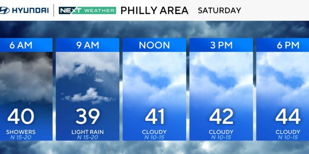
Saturday will bring high temperatures, but they will be 20 degrees colder. With the wind, we’re expected to stay in the 30s for the majority of the day.
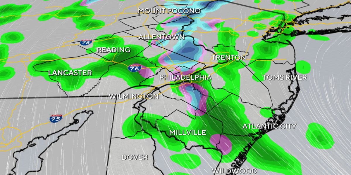
When combined with cloudy sky, it will be an excellent day for inside activities. Furthermore, with showers expected throughout the day, it will be cold enough for a few wet snowflakes to mix in, with a covering likely in Philadelphia’s northern and western suburbs.
Temperatures in the Poconos will be near freezing, with the ground frozen, so a snow shovel may be required if several inches or more of snow accumulates.
There may be significant impacts on road and aviation travel early Saturday morning. It is also the beginning of spring break in most of the area, so anyone travelling should be alert.
By Sunday, the rain will have stopped, but clouds will continue, with some late-day brightness. The good news is that temperatures have rebounded to around 60 degrees.
Monday and Tuesday are considerably warmer, with temperatures ranging from the upper 60s to around 70 degrees Fahrenheit with returning sunlight.
Saturday evening, when Passover begins, will be overcast and moist, with isolated showers likely. Overnight lows will range from the mid 30s to the low 40s.
Palm Sunday clouds with late-day sun and more seasonable highs about 60.
Easter week begins warmer, with a minor risk of scattered showers midway through and again late in the week. Easter Sunday looks moderate, dry, and sunny, with highs in the 50s.