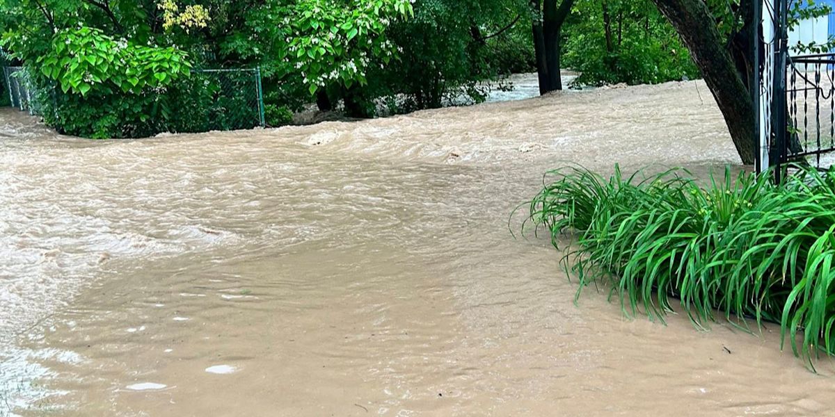
Prepare for a period of reasonably damp weather starting on Wednesday and continuing through the end of the week.
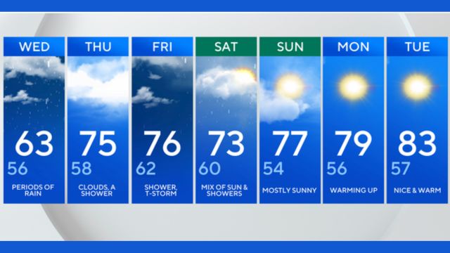
With the possibility of sporadic showers every day through Saturday, temperatures drop to the mid-60s on Wednesday before rising into the upper 70s by Thursday and Friday.
As some humidity begins to rise with south winds, keep an eye out for the rare thunderstorm even if the chances are low (about 20%).
As of right now, temperatures are expected to warm and dry out by the second half of the weekend, with highs of the mid-80s conceivable by Monday of the next week.
Back to the rain: Despite everything, there is some good news. We will probably have even better conditions when the weekly drought monitor is announced on Thursday since, for the first time in over eight months, the Philadelphia area is no longer under any drought scenarios, and that doesn’t include the one inch or so we received last Wednesday and Thursday.
Read Also: Summer Fun Returns as Illinois’ Largest Water Park Opens for the Season
7-day prediction
| Day | Conditions | High (°F) | Low (°F) |
| Wednesday | Periods of rain | 63 | 56 |
| Thursday | Clouds, a shower | 75 | 58 |
| Friday | Shower, thunderstorm | 76 | 62 |
| Saturday | Mix of sun and showers | 73 | 60 |
| Sunday | Mostly sunny | 77 | 54 |
| Monday | Warming up | 79 | 56 |
| Tuesday | Nice and warm | 83 | 57 |