A flood watch was expanded by the National Weather Service on Wednesday afternoon, and it now encompasses the majority of eastern Pennsylvania, including the counties of Berks, Bucks, Carbon, Chester, Delaware, Lancaster, Lebanon, Lehigh, Montgomery, Northampton, Philadelphia, and Schuylkill.
In addition, a significant portion of New Jersey is included in the watch zone. This includes the counties of Burlington, Camden, Gloucester, Hunterdon, Middlesex, Monmouth, Ocean, and Somerset.
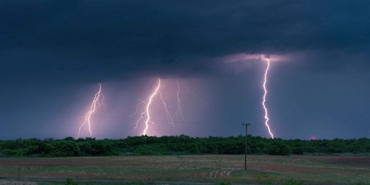
There is a watch in effect till Friday morning at six o’clock. In addition, flash flooding is a possibility.
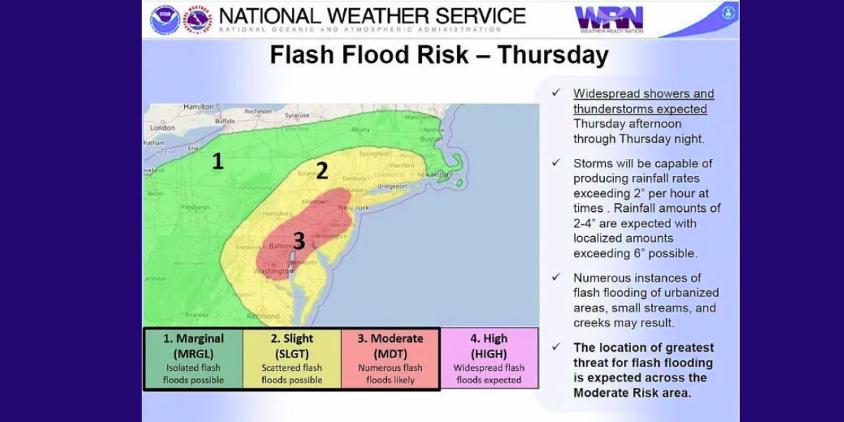
The National Weather Service office in Mount Holly, New Jersey, states that there is a potential for severe weather on Thursday, July 31, 2025, across the whole region that they serve. (With thanks to the NWS) In accordance with the National Weather Service, the flash flood danger area for Thursday, July 31, 2025 has been updated. (With thanks to the NWS)
“A warm and increasingly humid airmass will be in place ahead of an approaching cold front that will pass through the region Thursday night,” the NWS stated in its alert. “Showers and thunderstorms will be capable of heavy rain resulting in rainfall amounts of 2 to 4 inches with 6 inches or more in localized areas. Rainfall rates may exceed 2 inches per hour.”
On Thursday, the region will experience thunderstorms and a few strong thunderstorms before the extreme heat subsides.
The weather for tonight is expected to be largely clear with a low of about 74.
The NWS predictions There will be some sunshine on Thursday. With highs of 83 and lows of 65, the likelihood of showers and thunderstorms before 1 p.m. increases.
There is a chance of 1-2 inches of rain during the day and an extra 0.50 to 0.75 inches at night. Precipitation is 70% likely during the day and 90% likely at night.
An updated map from the National Weather Service indicates the likelihood of severe thunderstorms on Thursday, July 31, 2025. (Source: NWS)
Friday is expected to be generally cloudy throughout the day, with the risk of showers and thunderstorms before 8 a.m. There is a 60% chance of precipitation during the day and a 30% chance at night, with a high of 74 and a low of 60.
According to the NWS, Saturday and Sunday should be sunny with highs in the low 80s.