
The Northeast’s weekend outlook may seem familiar, and with good reason. For the sixth time in the last seven weekends, precipitation is predicted, with more rain and thunderstorms expected throughout the region.
“Outdoor plans are good for today,” FOX Weather Meteorologist Marissa Torres said. “By tomorrow, things are getting hairy.”
The first of two consecutive storm systems is expected to hit the area on Friday, according to the FOX Forecast Center. The extreme storms and flooding that occurred earlier this week in the central United States were also caused by this system.
A warm front moving through is expected to bring showers in the early morning hours of Friday, according to forecasters.
After that, warm, humid air will rush in behind the front, contributing to the atmospheric energy buildup that will cause some thunderstorms to form in the afternoon.
Strong wind gusts and hail could be produced by those storms, according to the FOX Forecast Center, but the overall risk of severe weather will be low due to modest wind shear, which is the change in wind direction and speed with height.
“Good chunks of the Northeast stay dry on Friday, but we also could see some rain around,” FOX Weather Meteorologist Stephen Morgan said. “I mean, it’s going to be scattered.”
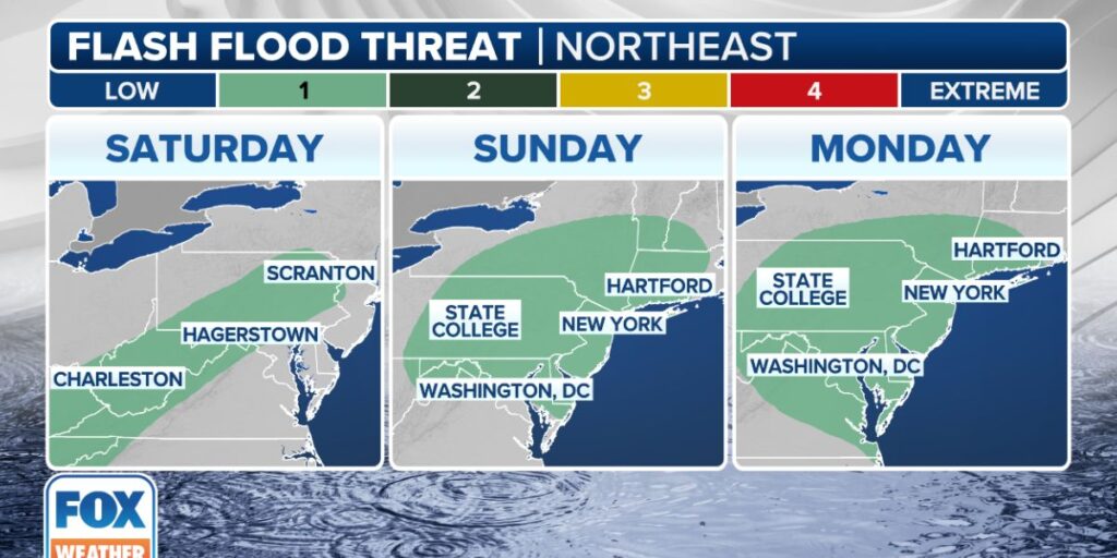
By Saturday, a second storm system will move eastward from the northern Plains, right on its heels.
“There are arguable moments where we could really be in, kind of like stuck in the heavy rain, but regardless, we’ll take it one day at a time,” Torres said. “So, Saturday, we do have the risk of some thunderstorms. And that goes from Boston all the way down into the northern part of Florida.”
Rain is quite likely to fall on Saturday, according to the FOX Forecast Center, but specifics are still very uncertain.
According to one computer forecast model, thunderstorms are more likely to occur near the Interstate 95 corridor from the Southeast to New England as the system moves across the Northeast and brings rain to the interior parts of the region. Then, by Sunday, it leaves the area.
When the second scenario is cut off from the jet stream, it stalls after bringing rain and thunderstorms to the whole region on Saturday.
While New England remains dry, the mid-Atlantic would have days of rain.
Rain is expected in places like Boston and New York City regardless of which scenario materializes.