This week, the central United States is expected to see daily rounds of dangerous thunderstorms, but no significant breakout of severe weather is anticipated, according to AccuWeather meteorologists.
Weather systems will zip right along from west to east across the U.S. this week. The forward speed of each system may keep a widespread outbreak from happening on any particular day, even though Gulf moisture will be present for the most of the period. Nonetheless, storms may strike some locations at least twice or three times this week, possibly on several days in a row.
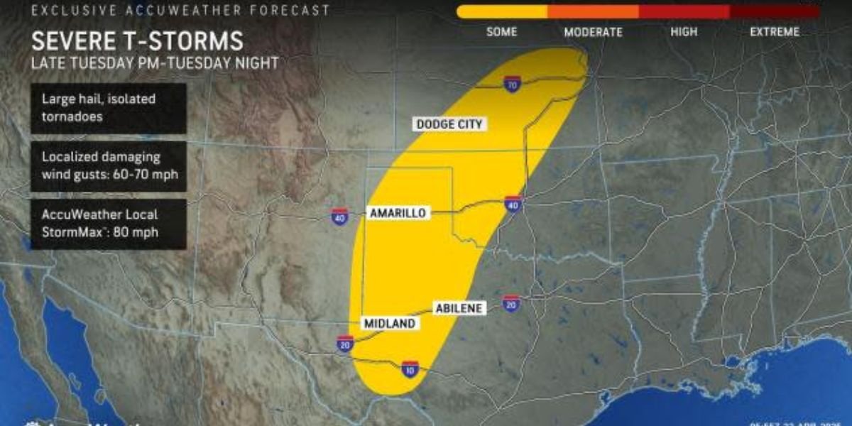
As a disturbance moves eastward from the Rockies on Tuesday, the risk of severe weather will shift further to the west.
From later Tuesday afternoon through Tuesday night, there will be localised severe thunderstorms from northeast Kansas to western Texas and extreme eastern New Mexico.
The largest thunderstorms have the potential to produce large hail, some of which are the size of baseballs. Some of the thunderstorms’ strong updrafts, which can bear the weight of such big hailstones, will also make their way to the ground as strong wind gusts. A few tornadoes might be produced, as is occasionally the case with strong thunderstorms.
Even the most powerful storms can cause substantial property damage.

By midweek, there will be a greater chance of severe thunderstorms moving north across the High Plains.
From eastern New Mexico and western Texas to central Nebraska, there will be localised strong thunderstorms, some of which may bring large hail, strong winds, and possibly even a tornado.
Although local drought may be momentarily alleviated by the storms’ downpours, broad soaking rain is not expected in this region.
On Thursday, strong thunderstorms will pass through a portion of the same region that was hit by severe thunderstorms on Tuesday and Wednesday.
The primary threat of severe weather on this day will run from western Texas to eastern Colorado and western Kansas but also spread farther to the east into the central sections of Texas, Oklahoma and Kansas.
Along with the risks of damaging hail and strong gusts, the recurrent nature of the storms over a period of days may raise the likelihood of flash flooding in places that are affected daily or more frequently.
As the week draws to a close, there is still a chance of severe thunderstorms over parts of the Plains, but the risk will also spread hundreds of miles further east over parts of the Ohio and Mississippi valleys.
A few pockets of strong storms with high winds, hail, and even a few tornadoes are anticipated instead of a large area of severe weather.
Much of the rain that falls over the southern and central Plains will occur in places that can handle a few inches of rain over several days. Further to the east, where rain has been a frequent visitor in recent days and weeks, flooding issues will become more prevalent.