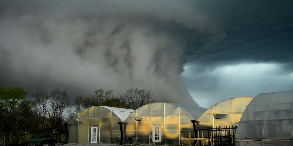
Radar detected rotation in a strong storm near Henrietta, prompting the National Weather Service to issue a tornado warning for portions of Lafayette and Ray counties in Missouri on Tuesday.
The storm was heading east at 45 miles per hour and had the potential to produce a tornado. People in the storm’s path were advised to seek cover right away.
In recent days, storms have struck several states, including Kansas, Alabama, Virginia, and Kentucky. In mid-May, a tornado struck Kentucky, killing at least 19 people.
Around half a million people were impacted by the warning, which was issued by the National Weather Service at 2:55 p.m. CT on Tuesday and covered the Kansas City and Pleasant Hill regions of the state.
Forecasters warned of the possibility of hazardous flying debris as a severe thunderstorm that could create a tornado passed over the region.
On its official X account, Kansas City said that its Emergency Operations Center was operational and advised citizens to avoid the streets unless absolutely required.
Images circulated on social media at approximately 3:49 p.m. revealed traces of a tornado and a lot of rain. In Kansas City, around 11,000 people were without power, and in Independence and Buckner, almost 2,700 customers were without electricity.
Read Also: Kansas Declares Flash Flood Emergency as Rescues Unfold in Wichita
The storm season is well under way, and Missouri and the neighboring states frequently receive the same warnings. As of Tuesday afternoon, NWS had 20 in effect throughout the United States.
The National Weather Service said in its tornado warning, “Move to a basement or an interior room on the lowest floor of a sturdy building. Avoid windows. If you are outdoors, in a mobile home, or in a vehicle, move to the closest substantial shelter and protect yourself from flying debris. Heavy rainfall may hide this tornado. Do not wait to see or hear the tornado. TAKE COVER NOW!”
A flood watch is in place through Wednesday, and the warning is in force until at least 8 p.m. CT.