Tuesday saw millions of people in Texas and Louisiana experience strong to severe storms with destructive hail and potentially fatal flooding, continuing a multiday danger of severe weather and flash floods.
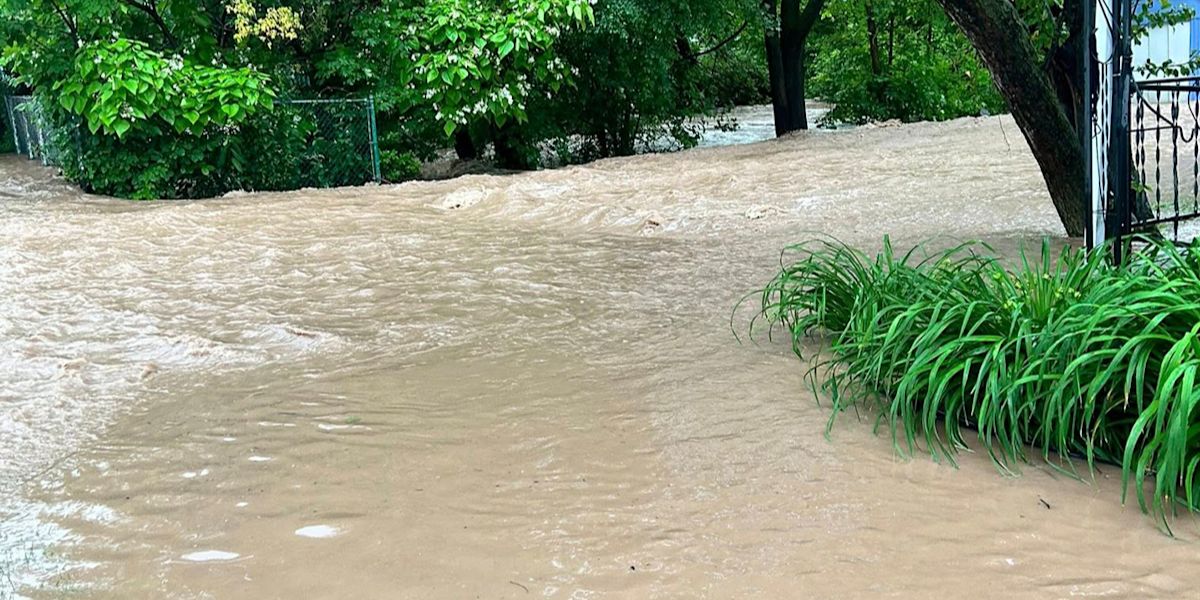
Search and rescue workers are still searching for a 10-year-old girl who was washed away by floodwaters in Central Texas, which puts her at risk.
Areas near Houston, Dallas, Fort Worth, and Austin were identified by NOAA’s Storm Prediction Centre forecasters as experiencing the worst weather.
In New Iberia, a severe warning storm produced hail the size of quarters to golf balls outside of New Orleans. This size of hail, according to meteorologists, will damage homes and vehicles and cause injuries to people and animals.
Outside of Waco, Texas, there were reports of structural damage, including roof damage and several downed trees.
Additionally, a violent thunderstorm that passed across rural North Texas caused damage to neighbouring airports and wind turbines.
The most of the damage in the Lone Star State, according to meteorologists, seemed to be caused by straight-line winds rather than tornadoes.
Millions of people are on high alert for possibly fatal flash flooding as strong storms sweep across the southern Plains and down the Gulf Coast, increasing the risk of flooding.
By Tuesday noon, parts of Louisiana and East Texas will be at the highest risk of flash floods.
Overnight, storms will keep hammering the region over Louisiana and into Mississippi along the Gulf Coast. By Wednesday morning, the Gulf Coast is predicted to see the most powerful storms and the most rain, which will eventually spread into the Florida Panhandle.
A few inches of rain are predicted for cities and towns from the southern Plains to the Southeast. The biggest totals, however, will be observed from East Texas through Louisiana and into Alabama and southern Mississippi.
Rainfall of 5-8 inches, with possibly locally higher totals, is forecast for southern Louisiana and southern Mississippi.